
A Messy Late-Winter Pattern Targets the North This Week
Winter holds on in the North as the South warms up
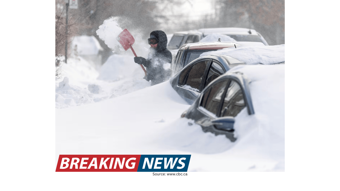
While many communities across the South are enjoying warmer temperatures, winter is still very much part of the picture across northern portions of the United States this week. The overall setup is shaping up to be a messy one, not necessarily because it will deliver the biggest snow totals of the season everywhere, but because it combines light snow with the chance of ice in several regions where even small amounts can create outsized travel problems.
The key theme for the next several days is that multiple areas will face periodic wintry precipitation. Today’s concerns extend from the Ohio Valley to the Appalachians, with impacts also possible in parts of the mid-Atlantic. As the week continues, additional snow and some ice are expected to affect portions of the Northeast and New England. For drivers and commuters, that mix of precipitation types is often the difference between a routine winter day and a difficult one.
Today’s focus: light snow and a chance of ice from the Ohio Valley to the mid-Atlantic
The immediate forecast highlights light snow and the chance of ice from the Ohio Valley into the Appalachians, with the possibility of wintry conditions reaching into parts of the mid-Atlantic today. In many situations, “light snow” can sound manageable. However, light snow can still create slick conditions—especially during the morning and evening commute windows when traffic is heavier and road temperatures may be less forgiving.
Ice is the bigger wildcard. Even a thin glaze can reduce traction dramatically, turning untreated roads, bridges, and overpasses into hazardous surfaces. That is why the chance of ice, even if it is not widespread, is an important part of this forecast. The areas mentioned—Ohio Valley, Appalachians, and parts of the mid-Atlantic—include a mix of terrain and road networks where conditions can vary quickly over short distances.
Commuters in these regions should be prepared for rapidly changing road conditions. A route that seems fine in one neighborhood can become slippery a few miles away, particularly in hilly locations or in places where precipitation changes from snow to a light icing. The combination of light snow and possible ice is also a common recipe for slower travel, longer braking distances, and minor accidents that can compound delays.
Why “messy” matters: small amounts can still cause big disruptions
In winter forecasting, the term “messy” is often used when precipitation type and timing are less straightforward for day-to-day planning. A clean, all-snow event can be disruptive, but it is at least predictable in how it behaves on roads and sidewalks. A mixed event—light snow here, a brief period of icing there—can be more difficult to manage because impacts are uneven and can occur in bursts.
This week’s setup underscores that point. Light snow can reduce visibility and create a thin layer of accumulation that becomes compacted by traffic. Add the possibility of ice, and even areas that do not see much snow can still experience dangerous travel. For many people, the most important question is not how many inches fall, but whether roads will be slick at the exact time they need to be on them.
Another reason messy setups are challenging is that they can change quickly. A slight shift in temperature can determine whether precipitation falls as snow, sleet, or freezing rain. While the forecast indicates a chance of ice, the practical takeaway is that travelers should be ready for localized slick spots, particularly on elevated surfaces and in shaded areas that may remain colder.
Commute concerns: where travel trouble is most likely
The forecast specifically notes that today’s wintry mix could mean trouble for commutes in the Ohio Valley, the Appalachians, and parts of the mid-Atlantic. Commute impacts do not require a major storm. They can be triggered by a narrow window of precipitation that coincides with peak travel time, or by a light but persistent wintry mix that gradually worsens road conditions.
In these regions, a few common trouble spots tend to stand out during light snow and icing events:
Bridges and overpasses: These surfaces can become icy faster than nearby roads.
Hills and mountain routes: The Appalachians, in particular, can see sharper changes in conditions with elevation.
Urban traffic corridors: Stop-and-go traffic can become more hazardous when roads are slick.
Secondary roads: Less-traveled routes may be slower to improve if precipitation lingers.
Because the expected precipitation includes both light snow and the chance of ice, it is reasonable for travelers to plan for extra time, reduced speeds, and the possibility of sudden slowdowns. Even if conditions look acceptable at the start of a trip, they can deteriorate quickly if a brief burst of snow or a patch of icing develops along the route.
Later in the week: additional snow and some ice for the Northeast and New England
After today’s wintry concerns farther south and west, the rest of the week brings additional snow and some ice to portions of the Northeast and New England. That suggests the pattern remains active, with more than one opportunity for winter weather to affect daily routines.
For the Northeast and New England, the mention of “additional snow and some ice” is important because it implies continued potential for travel disruptions, even if the exact timing and location of the worst conditions vary. Snow can slow travel and reduce visibility, while ice can create particularly hazardous driving and walking conditions. When both are in the mix over multiple days, the cumulative effect can be significant: repeated episodes of slick travel, repeated needs for caution during commutes, and repeated attention to changing conditions.
It is also worth noting that “portions” of the Northeast and New England are expected to be affected. That wording points to a forecast where impacts may not be uniform across the entire region. Some areas may see more snow, others may deal more with icing, and some may experience only minor effects. For residents and travelers, that means it is especially important to pay attention to the latest local forecast details as the week progresses.
What to watch for as the forecast evolves
When a week is described as a messy winter setup, the most practical approach is to focus on a few high-impact questions. Based on the current forecast outline—light snow and a chance of ice today from the Ohio Valley to the Appalachians and into parts of the mid-Atlantic, followed by additional snow and some ice in portions of the Northeast and New England later in the week—these are the kinds of factors that tend to matter most for daily decisions:
Timing of wintry precipitation: Impacts are often greatest when snow or ice occurs during commute hours.
Where ice is most likely: Even isolated icing can create dangerous travel, particularly on untreated surfaces.
Changes in precipitation type: A shift from snow to ice (or vice versa) can quickly change the level of hazard.
Regional differences: The forecast highlights specific corridors today and different areas later in the week, so conditions may vary widely.
As the week continues, the most useful updates will be those that narrow down where the highest risk of icing exists and when the next rounds of snow are expected in the Northeast and New England. In mixed winter events, the details often determine whether the day is merely inconvenient or genuinely difficult for travel.
Practical planning: minimizing disruption during light snow and ice
Even without diving into storm totals, there are practical ways to reduce the impact of a light-snow-and-ice forecast. The emphasis in this week’s outlook is on travel trouble, especially for commutes, so planning around transportation is a sensible priority.
For those in the Ohio Valley, Appalachians, and parts of the mid-Atlantic today, and for those in portions of the Northeast and New England later this week, consider the following general strategies:
Build in extra travel time: Light snow and possible ice can slow traffic quickly, even if precipitation is not heavy.
Expect variable conditions: Roads can change from wet to slick over short distances, particularly in higher terrain.
Be cautious on elevated surfaces: Bridges and overpasses can become icy before other roadways.
Monitor updates through the week: The pattern includes additional snow and some ice later in the week, so conditions may shift.
These steps are especially relevant in a forecast like this one, where the main concern is not necessarily a single blockbuster storm but a series of smaller winter hazards that can still interfere with daily life.
Bottom line
This week’s weather pattern draws a clear contrast across the country: warmer temperatures for many across the South, while winter continues to hang on across northern portions of the U.S. Light snow and the chance of ice are possible today from the Ohio Valley to the Appalachians and into parts of the mid-Atlantic, a combination that could mean trouble for commutes. Beyond today, additional snow and some ice are expected later in the week for portions of the Northeast and New England.
In a messy winter setup, the most important impacts often come down to timing and precipitation type. Light snow can still make roads slick, and a small amount of ice can quickly elevate travel risk. Keeping an eye on the latest forecast for your area throughout the week can help you plan around the periods most likely to bring winter travel headaches.