
Light Rain Greets Delhi After Season’s Warmest Day, While Air Quality Remains ‘Poor’
Morning drizzle follows an unusually warm spell
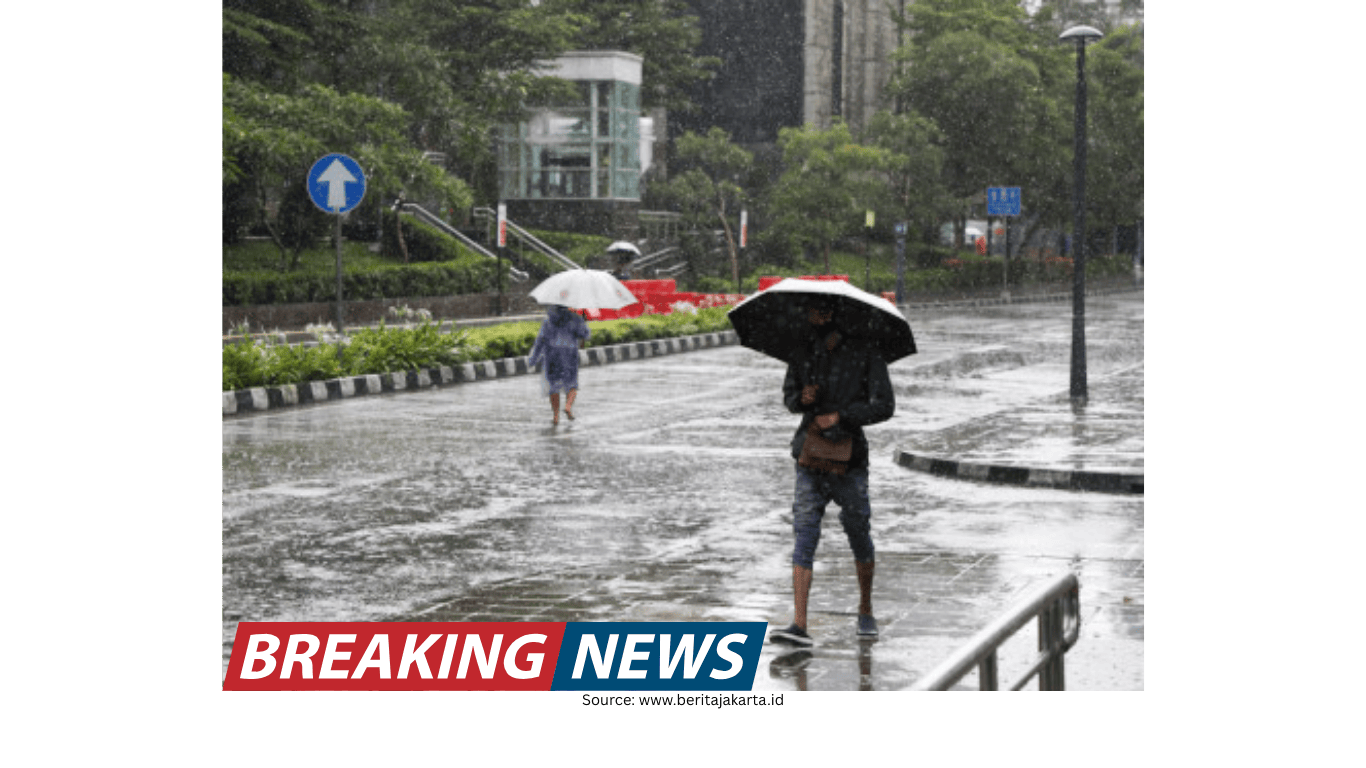
Residents of Delhi woke up to light rain on Wednesday, a shift in conditions that came immediately after the city recorded its hottest day of the year so far. On Tuesday, the maximum temperature climbed to 30.9 degrees Celsius, marking a notable spike for mid-February. The warmth has stood out in recent days, with the city experiencing temperatures well above what is typical for this time of year.
Even as the weather turned slightly wetter, air quality remained a persistent concern. At 8 a.m. on Wednesday, the Air Quality Index (AQI) was recorded at 228, placing it in the ‘poor’ category. The day before, Delhi’s AQI was also classified as ‘poor’, with a reading of 259, according to data from the Central Pollution Control Board (CPCB).
The combination of high temperatures, shifting cloud cover, and intermittent rain has made the week’s weather feel changeable. However, the pollution readings indicate that the brief rainfall did not immediately translate into broadly improved air quality across the city.
AQI remains elevated across multiple pockets of the city
CPCB data from Wednesday showed that air quality levels varied by locality, but many stations continued to report ‘poor’ readings and, in some cases, higher levels. Several areas recorded AQI numbers in the upper 200s and beyond, underlining that pollution remained elevated across multiple parts of Delhi.
Among the locations highlighted in the CPCB data were Anand Vihar, Ashok Vihar, Burari Crossing, Chandni Chowk, and DTU, each reporting high AQI values. Other areas such as Mundka, Rohini, Shadipur, Sonia Vihar, Vivek Vihar, and Wazirpur also recorded substantial readings, indicating that the air quality challenge was not confined to a single zone.
Some stations registered comparatively lower values than the most polluted hotspots, though they still reflected air quality concerns. For example, Dwarka Sector 8 reported 187, ITO recorded 180, and Pusa recorded 152. The IGI Airport (T3) station was listed as under monitoring.
The following AQI readings were reported in CPCB data on Wednesday:
- Anand Vihar: 285
- Ashok Vihar: 264
- Burari Crossing: 275
- Chandni Chowk: 286
- DTU: 249
- Dwarka Sector 8: 187
- IGI Airport (T3): under monitoring
- ITO: 180
- Jawaharlal Nehru Stadium: 187
- Mundka: 309
- Narela: 283
- Okhla Phase-2: 242
- Pusa: 152
- R.K. Puram: 221
- Rohini: 306
- Shadipur: 296
- Sonia Vihar: 294
- Vivek Vihar: 284
- Wazirpur: 336
These figures illustrate how air quality can differ across neighbourhoods at the same time, influenced by local conditions and broader atmospheric patterns. While some areas were closer to the lower end of the ‘poor’ band, others approached or crossed into higher ranges, reinforcing the uneven distribution of pollution across the capital.
IMD outlook: light rain, gusty winds, and a yellow alert
The India Meteorological Department (IMD) forecast very light to light rainfall for Wednesday, along with gusty winds expected during the afternoon. Wind speeds were predicted to range from 30 to 40 kilometres per hour. The day’s temperatures were also expected to be milder than Tuesday’s peak, with the maximum and minimum likely to hover around 27 degrees Celsius and 14 degrees Celsius, respectively.
Alongside the rainfall forecast, the IMD issued a yellow alert for Delhi and predicted cloudy skies for the day. The forecast described the possibility of multiple short spells of precipitation rather than a single continuous period of rain. According to the IMD, the city could see very light rain accompanied by thunderstorms and lightning at isolated places during the morning hours.
The weather agency also indicated another spell of very light to light rain, again with thunderstorms and lightning at isolated places, likely towards the forenoon. This phase was expected to coincide with gusty winds reaching 30–40 kmph. A further spell of very light rain was anticipated at isolated places during the afternoon.
In practical terms, this kind of forecast suggests a day of intermittent changes—cloud build-up, brief showers, and occasional wind—rather than a prolonged wet spell. Such conditions can also affect visibility and comfort levels, especially when combined with ongoing air quality concerns.
Mid-February warmth stands out in Delhi’s recent weather
Delhi has been witnessing unusual warmth for mid-February. The IMD noted that Monday (February 16) recorded the highest temperature of the season so far, and Tuesday (February 17) pushed the mercury even higher to 30.9 degrees Celsius. The temperature on Tuesday was around 6.5 degrees Celsius above the normal average for this time of year, placing it among the warmest February days in recent weeks.
This context is important because it frames Wednesday’s light rain not as an isolated event, but as part of a broader pattern of fluctuating conditions. A sharp rise in daytime temperatures followed by cloudier skies and light rain can create a sense of sudden transition, particularly for residents accustomed to cooler mid-February weather.
While the forecast pointed to slightly lower maximum temperatures on Wednesday compared to Tuesday, the overall picture remains one of a season that has already delivered unusually warm days. The return of clouds and showers may offer temporary relief from the heat, but the persistence of ‘poor’ AQI readings indicates that weather changes alone may not immediately resolve air quality issues.
Weather system extends beyond Delhi into neighbouring regions
The IMD said scattered showers were expected to extend into parts of Haryana, Uttar Pradesh, and Rajasthan over the next few hours. This suggests that the weather system influencing Delhi was not limited to the capital and could affect a wider area across north India.
Forecasts for nearby cities reflected similar conditions. In Noida, the IMD predicted generally cloudy skies with light rain for Wednesday. The maximum and minimum temperatures in Noida were expected to remain around 26 degrees Celsius and 11 degrees Celsius, respectively. For the next few days, mainly clear skies were forecast for the region.
Gurugram was also expected to see partly cloudy skies, with one or two spells of rain or thundershowers likely during the day. Temperatures in Gurugram were forecast to hover around 28 degrees Celsius for the maximum and 14 degrees Celsius for the minimum. Clear skies were also predicted for the coming few days in Gurugram.
Together, these forecasts point to a brief window of unsettled weather across the Delhi-NCR area, followed by clearer conditions in the days ahead—at least based on the outlook provided for Noida and Gurugram.
Areas likely to receive rain: Haryana, Uttar Pradesh, and Rajasthan
The IMD further stated that light rainfall was very likely over parts of Haryana, Uttar Pradesh, and Rajasthan over the next two hours. It listed several specific areas expected to receive rain, indicating a fairly broad spread of potential precipitation across districts and towns in the region.
Areas expected to receive rain included the following:
- Haryana: Sonipat, Kharkhoda, Charkhi Dadri, Mattanhail, Jhajjar, Farukhnagar, Kosali, Mahendargarh, Sohna, Rewari, Palwal, Narnaul, Bawal, Nuh, Aurangabad, Hodal
- Uttar Pradesh: Bagpat, Khekra, Modinagar, Pilakhua
- Rajasthan: Bhiwari, Tizara, Khairthal, Alwar, Viratnagar, Nagar, Laxmangarh, Rajgarh
In addition, the IMD said very light rainfall or drizzle was likely in more locations across the same states, suggesting that some areas could see only brief or minimal precipitation rather than heavier showers.
Locations where very light rainfall or drizzle was considered likely included:
- Haryana: Kurukshetra, Kaithal, Narwana, Karnal, Fatehabad, Assandh, Safidon, Barwala, Jind, Panipat, Adampur, Gohana, Gannaur, Hansi, Tosham, Rohtak
- Uttar Pradesh: Shamli, Kandhla, Khatauli, Sakoti Tanda, Hastinapur, Baraut, Daurala, Meerut, Kithor, Garhmukteshwar, Hapur, Gulaoti, Siyana, Sikandrabad, Bulandshahar, Khurja, Jattari, Nandgaon, Barsana
- Rajasthan: Kotputli, Deeg
This detailed listing underscores how the day’s weather was expected to influence a wide corridor beyond Delhi, with varying intensity from light rain to drizzle depending on location.
What the day’s conditions mean for residents
For Delhi residents, Wednesday’s outlook combined several elements: light rain, gusty winds, and the possibility of thunderstorms and lightning at isolated places. At the same time, air quality remained in the ‘poor’ category, with multiple monitoring stations reporting elevated AQI levels across the city.
The forecast maximum temperature of around 27 degrees Celsius suggested a slight easing from Tuesday’s 30.9 degrees Celsius, though the broader pattern of unusual mid-February warmth remained evident. With a yellow alert in place and cloudy skies expected, the day was set to be more changeable than the previous day’s heat.
Across the wider region, including Noida and Gurugram, similar cloud-and-rain conditions were forecast for Wednesday, followed by mainly clear skies over the next few days. Meanwhile, parts of Haryana, Uttar Pradesh, and Rajasthan were also expected to experience light rainfall or drizzle, reflecting the reach of the same weather system.
As conditions shift through the day, local variations—both in rainfall and pollution levels—are likely to remain a defining feature of the region’s weather, with some areas seeing brief showers and others experiencing only light drizzle or cloudy skies.