
Easterlies to Bring Isolated Rains Over Metro Manila and Several Parts of the Philippines
Warm, humid easterlies set the tone for the next 24 hours
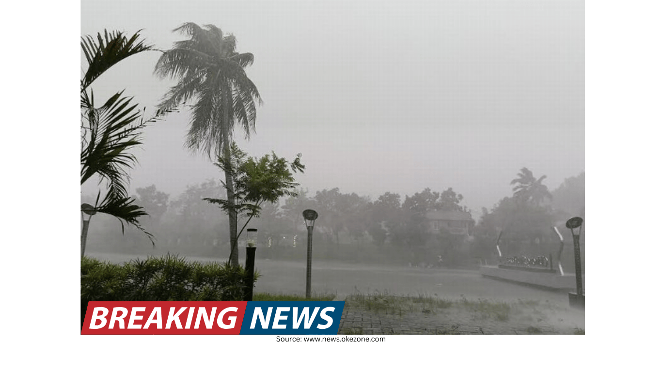
Humid and warm weather associated with the easterlies is expected to influence conditions over Metro Manila and the rest of the Philippines within the next 24 hours, based on the latest advisory from the state weather agency. The pattern typically produces a mix of sunshine and cloud build-up, which can lead to isolated rain showers or thunderstorms, especially when daytime heating helps clouds develop.
For Metro Manila, the forecast points to partly cloudy to overcast skies with isolated rain showers or thunderstorms. While the rains are expected to be isolated rather than widespread, residents should still anticipate brief downpours, localized thunderstorm activity, and sudden changes in sky conditions—common features of weather dominated by moist, warm air.
No low-pressure area monitored inside or outside the country’s area of responsibility
In a 5 a.m. briefing, weather specialist Veronica Torres said the Philippine Atmospheric Geophysical and Astronomical Services Administration has not observed any low-pressure area forming either inside or outside the country’s area of responsibility. This means that, at present, the forecast is being shaped primarily by existing seasonal and regional wind patterns rather than by a developing tropical system.
Even without a low-pressure area, the atmosphere can still produce rain, particularly when moisture is abundant and local conditions support cloud formation. Under easterly winds, rain events often occur in scattered pockets, with some communities experiencing showers while nearby areas remain dry.
Shear line continues to affect parts of Luzon
Alongside the easterlies, another weather system is influencing conditions in several areas: the shear line, described as the convergence of hot and cold air. This boundary can enhance cloudiness and increase the likelihood of rain, particularly when moisture is present.
The shear line has been affecting the following provinces:
- Cagayan
- Isabela
- Aurora
- Quezon
- Rizal
In these areas, the expected conditions include cloudy skies with scattered rain showers and isolated thunderstorms. Compared with isolated showers, “scattered” rainfall suggests a higher coverage of rain-producing clouds across a wider area, which can increase the chance that more communities will see rain at some point in the day.
Risk advisory: possible flash floods or landslides in affected areas
The forecaster also warned that flash floods or landslides may be possible in locations affected by the shear line, particularly where moderate to at times heavy rains occur. This risk is tied not only to the intensity of rainfall but also to local terrain and drainage conditions. Communities in flood-prone low-lying areas and those near slopes or mountainous terrain are typically more vulnerable when heavier bursts of rain develop.
Because the forecast includes the possibility of moderate to heavy rain at times, residents in the listed provinces may want to remain attentive to changing conditions during periods of persistent cloudiness and thunderstorms.
More areas may see overcast skies and scattered rains due to easterlies
Beyond Metro Manila, the easterlies are also expected to bring overcast skies with scattered rains and thunderstorms over several parts of the country. The state weather agency identified the following areas as likely to experience these conditions:
- Western Visayas
- Palawan
- Basilan
- Sulu
- Tawi-Tawi
Overcast conditions can limit daytime heating, but the presence of warm, moisture-laden air can still support thunderstorm development. In areas listed above, rain may occur in multiple locations, with thunderstorms possible. As with many rain events linked to easterly winds, timing can vary from one locality to another, and rainfall may be intermittent.
Northeast monsoon (amihan) continues over northern Luzon
While easterlies and the shear line shape weather elsewhere, the northeast monsoon—locally known as “amihan”—is expected to prevail over parts of northern Luzon. The state weather agency said amihan will affect:
- Ilocos Region
- Cordillera Administrative Region
- the rest of Cagayan Valley
In these areas, the forecast calls for partly cloudy to cloudy skies with isolated light rains. Compared with the shear line-affected provinces where moderate to heavy rain may occur at times, the rains linked to amihan in these northern areas are described as light and isolated.
What the forecast means for daily routines in Metro Manila and nearby provinces
For Metro Manila and many other parts of the country, the key message of the outlook is variability: skies may shift between partly cloudy and overcast, and rain may arrive in short-lived but sometimes intense bursts. Isolated rain showers and thunderstorms can develop quickly, particularly when cloud build-up accelerates. This kind of weather can affect commuting and outdoor plans, even if rainfall does not persist for long periods.
In provinces influenced by the shear line—Cagayan, Isabela, Aurora, Quezon, and Rizal—the mention of scattered rains and isolated thunderstorms, along with the warning about flash floods or landslides, signals a need for closer attention to rainfall intensity. Moderate to heavy rain, even if intermittent, can raise the risk of sudden flooding in some areas and slope instability in others.
Regional snapshot: expected sky conditions by weather driver
The current outlook can be understood by grouping areas according to the weather system influencing them. Based on the advisory, the following summary captures the expected conditions:
- Easterlies (humid, warm winds): Metro Manila and much of the country; partly cloudy to overcast with isolated rain showers or thunderstorms. Over Western Visayas, Palawan, Basilan, Sulu, and Tawi-Tawi: overcast with scattered rains and thunderstorms.
- Shear line (convergence of hot and cold air): Cagayan, Isabela, Aurora, Quezon, and Rizal; cloudy skies with scattered rain showers and isolated thunderstorms; possible flash floods or landslides due to moderate to at times heavy rains.
- Northeast monsoon / amihan: Ilocos Region, Cordillera Administrative Region, and the rest of Cagayan Valley; partly cloudy to cloudy skies with isolated light rains.
Why conditions can differ sharply from one area to another
The forecast highlights three distinct drivers—easterlies, a shear line, and the northeast monsoon—operating at the same time across different regions. This setup can produce contrasting weather even within the same island group. For example, some areas may see mostly fair skies punctuated by brief showers, while others experience longer periods of cloudiness and more frequent rain.
Under easterlies, rain is often described as isolated because it can be localized, affecting one district or municipality while sparing another nearby. Under a shear line, cloud bands and rain areas can become more organized, increasing the likelihood of broader coverage and heavier bursts. Under amihan, cloudiness and light rains can occur, particularly in areas where the monsoon flow favors moisture and cloud formation.
Staying alert during isolated thunderstorms
Even when rains are forecast as isolated, thunderstorms can still be disruptive. Sudden downpours may reduce visibility on roads, and brief heavy rain can lead to water accumulation in low-lying spots. The advisory’s emphasis on isolated rain showers or thunderstorms for Metro Manila and many other locations suggests that people may experience quick shifts in weather conditions within the day.
In shear line-affected provinces, the added note about possible flash floods or landslides underscores that the main concern is not only the presence of rain but also the potential for moderate to heavy rainfall at times. In such situations, conditions can change quickly, especially during periods of sustained cloudiness and thunderstorm activity.
Outlook remains focused on existing wind patterns and convergence
With no low-pressure area spotted inside or outside the country’s area of responsibility, the near-term forecast remains centered on the influence of the easterlies, the ongoing shear line, and the northeast monsoon over northern Luzon. These systems are sufficient to bring cloudiness and rain to various parts of the Philippines, even without a developing tropical cyclone or organized low-pressure disturbance.
For the next 24 hours, the public can expect a familiar mix of warm, humid conditions and intermittent rainfall in many areas—ranging from isolated showers in Metro Manila and elsewhere, to scattered rains and thunderstorm chances in specific regions, and isolated light rains in parts of northern Luzon under amihan.